Built for Trail Riders, Hikers & Island Adventurers
Everything in PingPath — from interactive region trail maps and headphone voice cues to Apple Watch haptics, private group maps, and offline GPS recording.
Interactive Adventure Region Maps
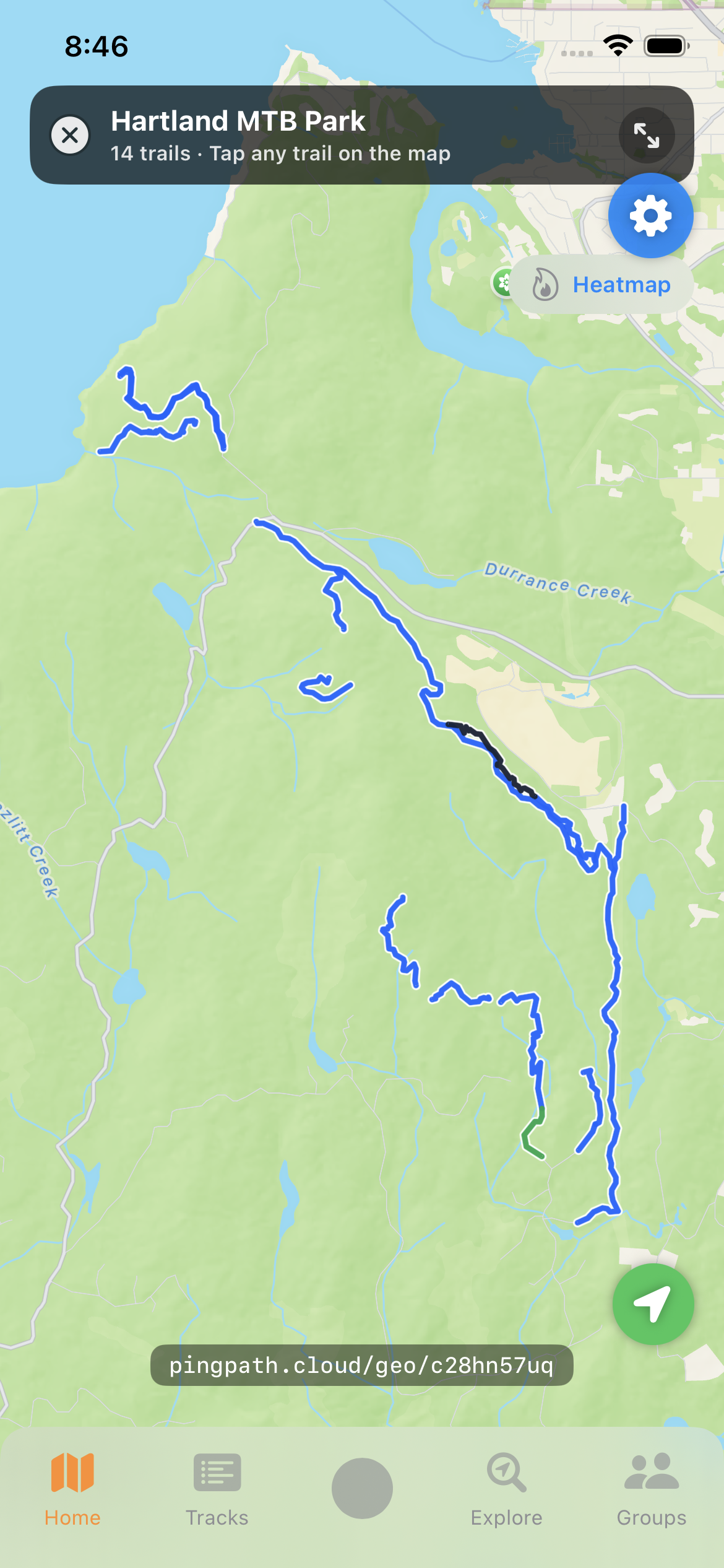
Explore entire riding destinations like Hartland on a single interactive map. Every trail in the region is plotted with Strava-style high-contrast casing and color-coded by difficulty.
- Color-coded trail lines for White, Green, Blue, Black, Double Black, and Pro lines
- Tap or click any trail on the map to view difficulty, distance, and climb/descent in a popup card
- Street-address-first trailhead parking cards with one-tap Google Maps directions
- Full-screen map mode on both desktop and mobile browsers
Detailed Trail Guides & YouTube Previews
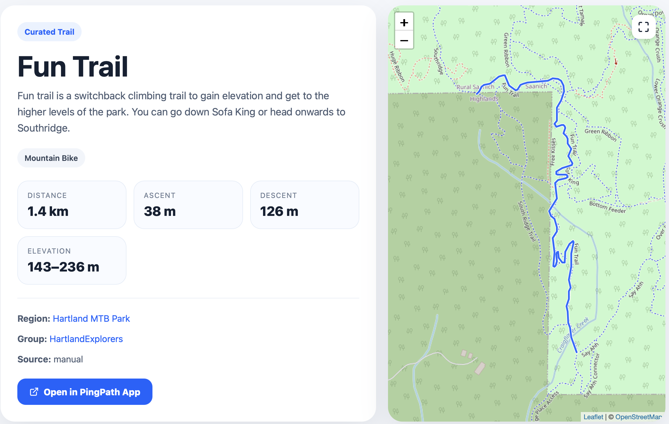
Each trail has its own dedicated page with complete stats, elevation metrics, trail direction, surface notes, and embedded YouTube ride videos so you can preview features before dropping in.
- Distance, ascent, descent, elevation range, average grade, max grade, and physical rating
- Downhill-only, uphill-only, and two-way direction badges plus bike type & dog policy
- Embedded YouTube trail videos and cross-links to every group and route in the area
- One-tap "Open in PingPath App" button that launches the trail directly on your phone map
Wayfinding, Voice Prompts & Apple Watch Haptics
Follow any trail, curated route, or recorded track with hands-free audio cues in your headphones and tactile wrist haptics on your Apple Watch.
- Trailhead wayfinding: guides you by compass bearing and distance to the start of the trail
- Live rotating directional arrow on both iPhone and Apple Watch that tracks your heading
- Automatic turn detection (Bear/Turn/Sharp Left & Right) with distance countdowns
- Spoken headphone instructions that briefly duck music/podcasts for turns and off-trail alerts, with a quick mute button on the map
- Distinct Apple Watch wrist haptics for left/right turns, off-trail recovery, and trail finish
Public & Private Riding Groups + Protected Trail Maps
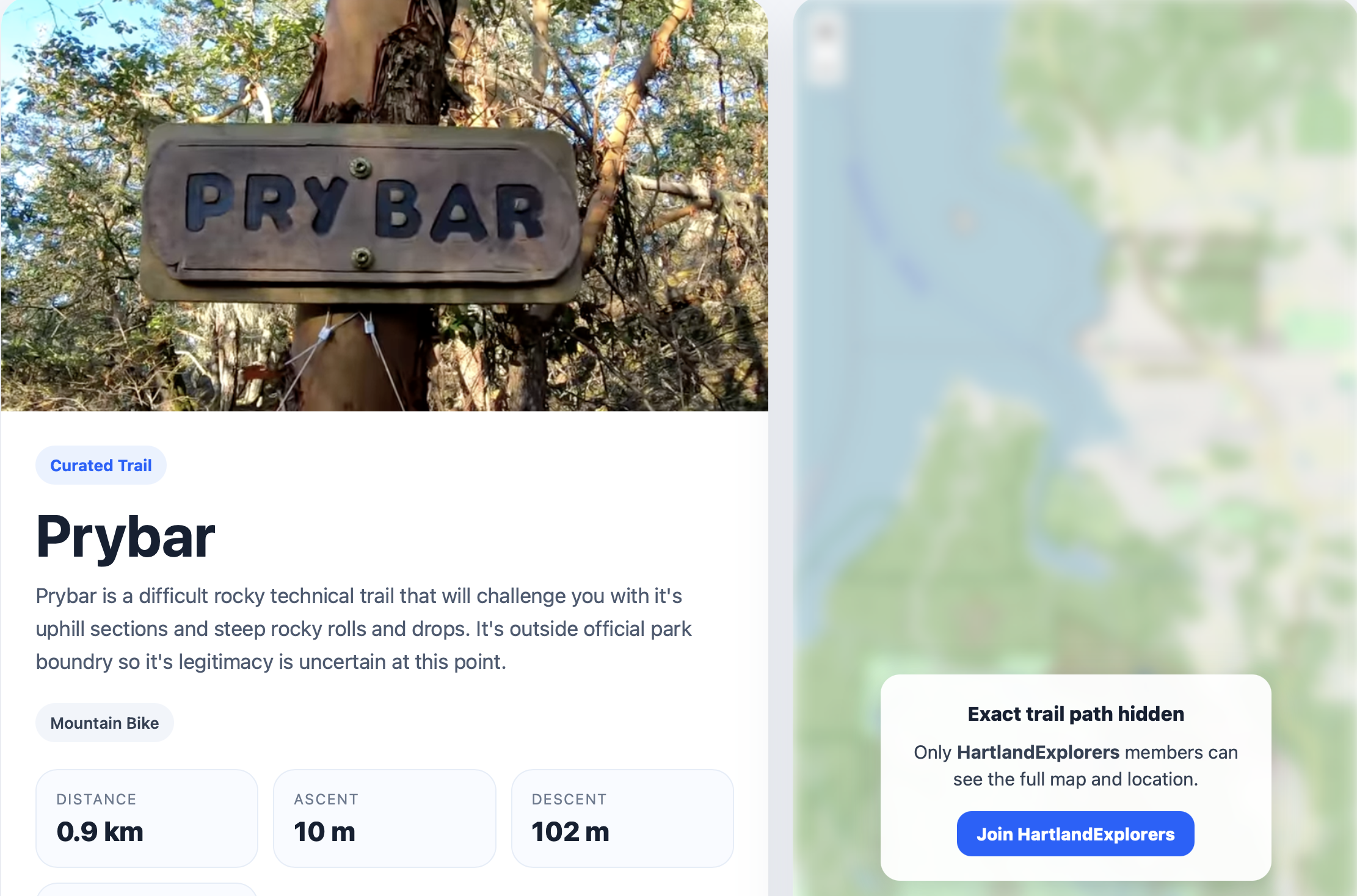
Build your local riding crew with public or private groups. Share group tracks, pinned trails, and discussion boards while keeping sensitive trail geometry protected.
- Public groups for open community rides and private groups with member request/approval workflows
- Protected member-only trail maps: hidden trails stay discoverable in search with a veiled preview map, automatically unlocking the real GPS line for group members
- Separate Regular Trails and Private Trails sections on group pages
- In-app group discussion forums and shared recent group tracks
Two-Way Apple Watch & iPhone Remote Control
Record on your iPhone in your backpack and use your Apple Watch as a live handlebar/wrist remote — or record standalone on your Watch and control it from your phone.
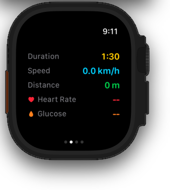
- Live stats mirroring: see your iPhone's live duration, speed, and distance right on your Apple Watch alongside Watch heart rate
- Pause, Resume, or Stop & Save an iPhone ride directly from your wrist (and via the Apple Watch Ultra Action Button)
- Start or stop an Apple Watch workout remotely from the iPhone Record tab
- Standalone Apple Watch GPS recording with HealthKit workout integration and automatic track sync
Offline-First Recording, Crash Recovery & Spike Filtering
Engineered for backcountry riding where cell service drops out. Every point is persisted locally first and synced in batches when you're back in range.
- Offline SwiftData storage with automatic background batch upload and retry
- Automatic interruption recovery: seamlessly resumes your active recording if iOS terminates the app mid-ride
- Multi-stage GPS anomaly & spike filter that strips cold-start jumps and cell-tower teleports
- iOS Lock Screen & Dynamic Island Live Activity displaying live ride duration and distance
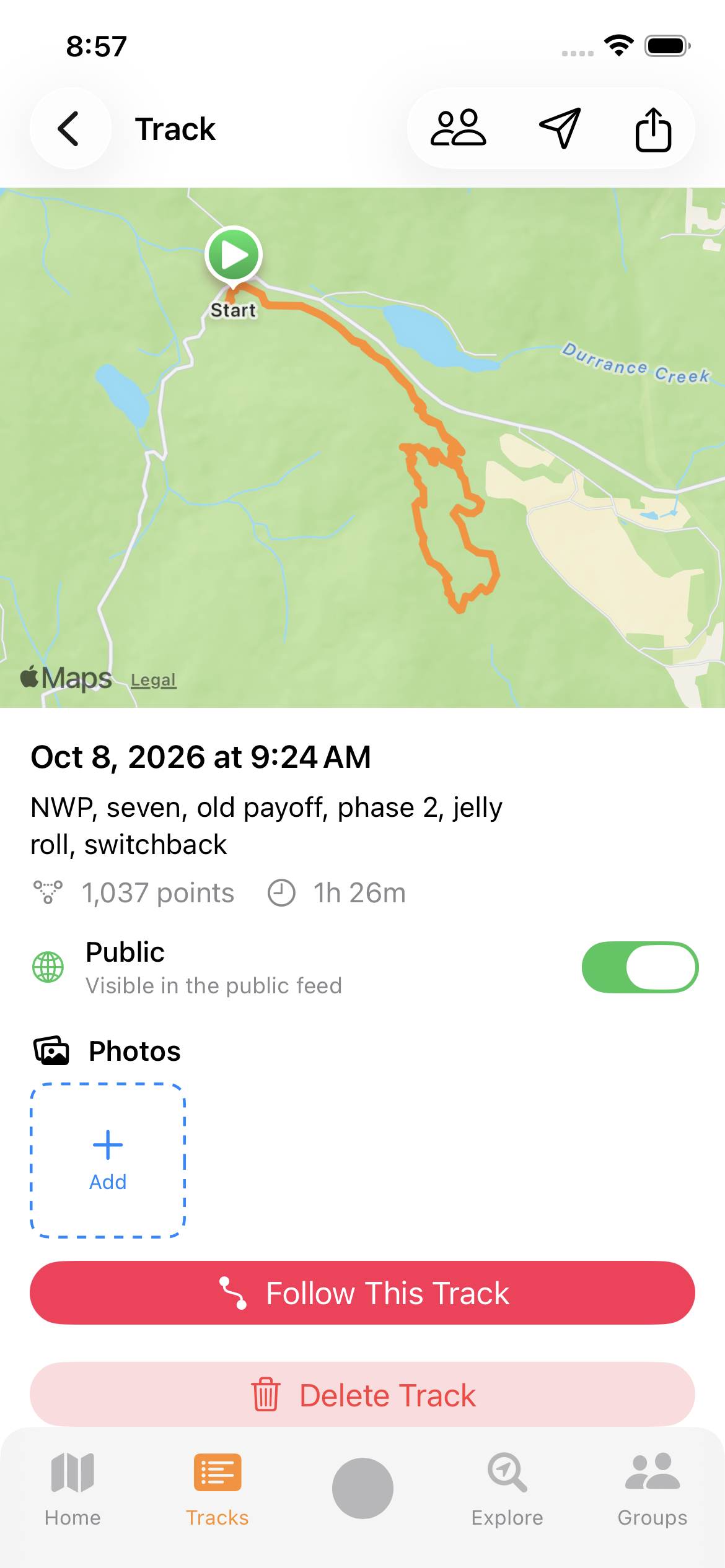
Geotagged Trail Photos, Photo Maps & Share Cards
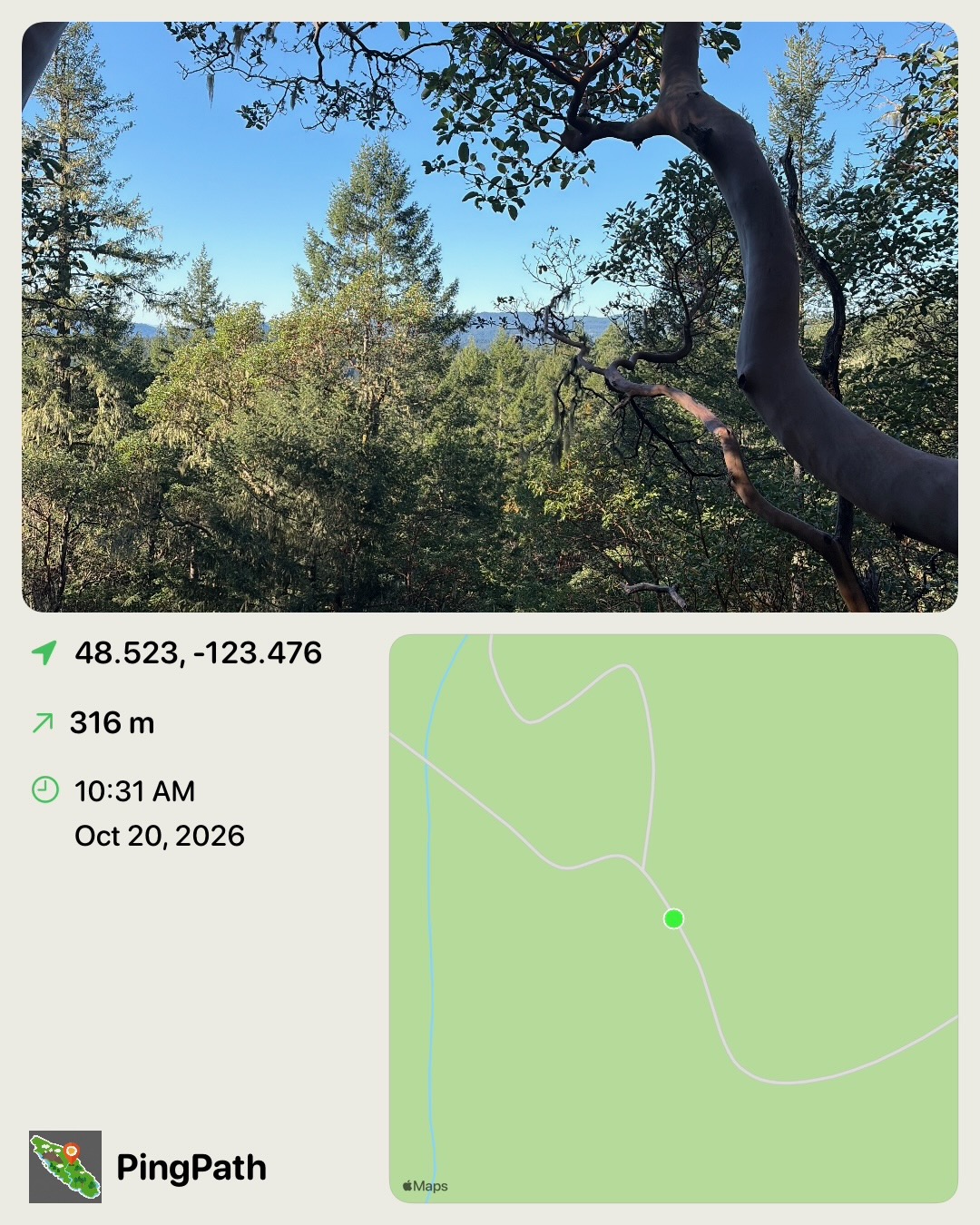
Capture photos mid-ride that pin to the exact spot on your GPS track, or generate shareable route overlay cards for social media and group chats.
- In-ride camera attaches geotagged photos to your track and saves a copy to your camera roll
- Interactive photo pins along your track map on both the iOS app and public web track pages
- Photo Map camera and Workout Share Card generator with custom route outlines and ride stats
- Recently Shared Photos showcase on the PingPath homepage
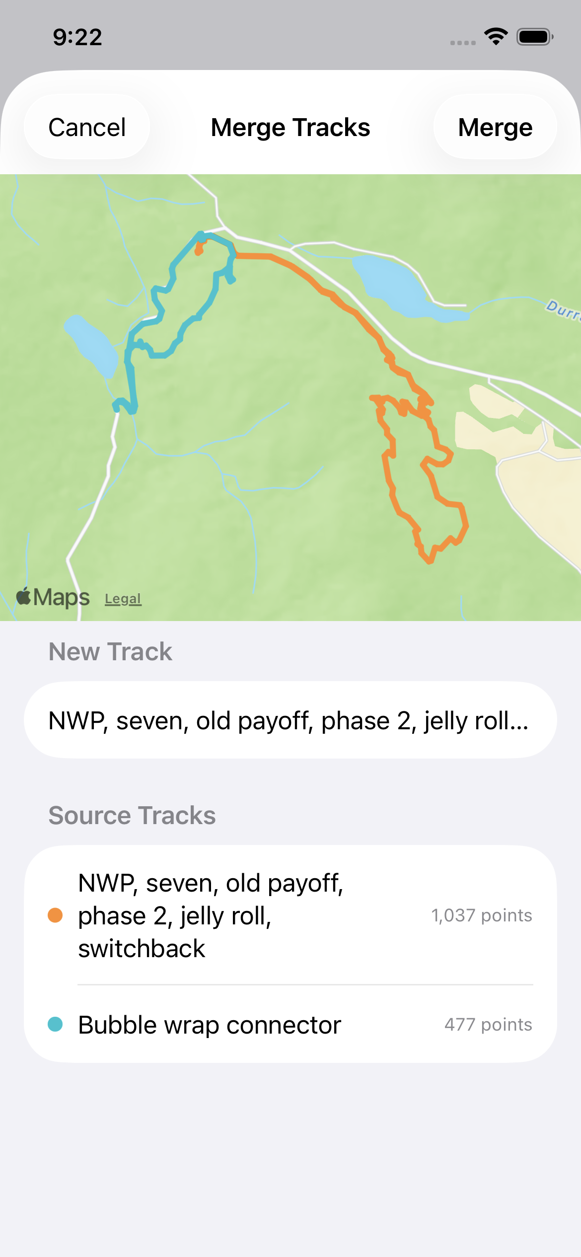
Track Merging, GPX Export, Topo Layers & Glucose Monitoring
Power-user tools for trail builders, adventure riders, and endurance athletes.
- Merge multiple recorded tracks into one combined ride with per-segment color coding
- One-tap GPX file export from any local or synced track, plus track submission for curated routes
- Switch between Apple Maps, OpenStreetMap, OpenTopoMap contours, and the community GPS Heatmap overlay
- Live MET-based calorie burn, moving time, and optional Dexcom Share continuous blood glucose display (mg/dL or mmol/L) on iPhone and Apple Watch
Ready for your next adventure?
Create a free account on the web or download PingPath for iPhone, Apple Watch, and Android.